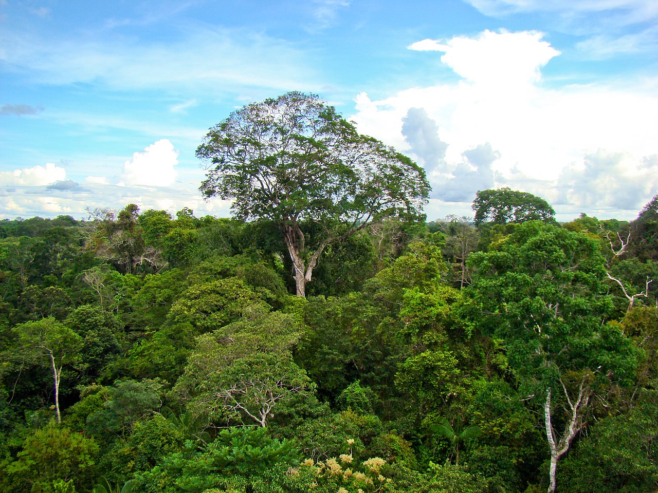
Nestled in the Peruvian Amazon, the Ucayali region stands as a testament to the planet’s extraordinary biodiversity and rich cultural heritage. Spanning an immense 102,400 km², making it Peru’s second-largest region, Ucayali is a mosaic of dense tropical rainforests, winding rivers, and diverse ecosystems. This vibrant territory, forming a crucial part of the Amazon basin, is not only a sanctuary for countless species, many yet unknown to science, but also the ancestral home to 18 distinct indigenous peoples who speak approximately 14 indigenous languages. However, this emerald heart of Peru is under relentless siege.
Accelerating deforestation, driven by a confluence of human activities, is carving deep wounds into its landscapes, threatening its ecological integrity, the unique cultures it cradles, and the vital environmental services it provides to the region and the world. This report offers a comprehensive examination of the multifaceted impacts of deforestation in the Ucayali rainforest, supported by statistical evidence, to illuminate the scale of the crisis and the urgent need for concerted action.
A Forest in Crisis: Deforestation Statistics in Ucayali
The scale of forest destruction in Ucayali is alarming, with data painting a grim picture of accelerating loss over the past two decades. Between 2001 and 2023, the Ucayali region lost 790,000 hectares (kha) of tree cover, which is equivalent to a 7.7% decrease in its tree cover since the year 2000. This figure is staggering, representing an area roughly equivalent to the size of Puerto Rico, which was lost between 2001 and 2024, contributing 560 million tons (Mt) of CO2e emissions to the atmosphere.
In 2020, Ucayali still possessed 9.52 million hectares (Mha) of natural forest, covering 91% of its land area. However, the continued onslaught is evident, as in 2023 alone, the region lost 40,900 hectares of natural forest, releasing an estimated 34.1 Mt of CO2 emissions.
The loss of primary forest—the most biodiverse and carbon-rich type of forest—is particularly concerning. From 2002 to 2023, Ucayali lost 558 kha of humid primary forest, accounting for a staggering 72% of its total tree cover loss during that period. This represents a 5.8% decrease in the total area of humid primary forest in Ucayali over these two decades. The sheer volume of these figures indicates more than just felled trees; it signifies a profound alteration of the landscape and a severe blow to global climate regulation efforts.
The carbon emissions resulting from this deforestation are substantial. Between 2013 and 2017 alone, the Ucayali region was second only to Loreto in carbon loss from deforestation in the Peruvian Amazon, losing 13.2 million metric tons of carbon. Accumulated emissions from deforestation in Ucayali between 2001 and 2018 amounted to 194 million tons of CO2eq.
The loss of this carbon sink capacity, particularly from mature and peat-rich forests like the aguajales, has direct implications for global warming. The fact that the region still holds approximately 1,295 million tons of carbon in its above-ground biomass (as of 2019) highlights the immense carbon stocks still at risk. The trend of increasing annual deforestation, from an average of 11,400 km2 between 2001-2004 to over 30,000 km2 in more recent years, signals an escalating crisis that demands immediate and effective intervention.
The Drivers: What’s Fueling the Chainsaws in the Ucayali?
The rampant deforestation in Ucayali is not a monolithic phenomenon but is propelled by a complex interplay of direct and indirect drivers. Analysis of forest loss patterns reveals that agricultural expansion, in its various forms, stands as the predominant force reshaping Ucayali’s landscape.
Agricultural Expansion: The Primary Culprit
Data from 2001 to 2024 indicates that permanent agriculture was the single largest driver of deforestation in Ucayali, accounting for 585,000 hectares of tree cover loss. This broad category encompasses both large-scale agribusiness and smaller farming operations.
- Large-Scale Agribusiness (Oil Palm and Cacao): The expansion of industrial agriculture, particularly for oil palm and cacao, has had a devastating impact. A report by the Environmental Investigation Agency (EIA) revealed that palm oil and cacao companies were responsible for clearing approximately 13,000 hectares of Amazon forest in Loreto and Ucayali between 2012 and 2021.
- Small/Medium-Scale Agriculture and Cattle Pasture: These are considered the most dominant drivers overall in the Peruvian Amazon. Raw deforestation data is often dominated by numerous small clearings, most likely attributed to agriculture or cattle pasture. Cattle pasture, specifically, has been identified as a major driver in the central Peruvian Amazon, including parts of Ucayali. Shifting cultivation also contributes, accounting for 106,000 hectares of tree cover loss in Ucayali between 2001 and 2024.
Logging Activities
Ucayali is one of Peru’s largest timber-producing regions, and logging activities, both legal and illegal, contribute significantly to forest degradation and deforestation. Between 2001 and 2024, logging was identified as a driver for 35,800 hectares of tree cover loss, categorized as a temporary disturbance. However, illegal logging is a pervasive issue and a significant contributor to overall deforestation in the region.
While selective logging might theoretically allow for forest regeneration, the reality is often more complex. Logging operations necessitate the construction of roads, which then open up previously inaccessible forest areas. These roads frequently become conduits for further deforestation by agriculturalists and settlers, leading to permanent forest conversion. Thus, the indirect impact of logging, by facilitating other deforestation drivers, is often far greater and more permanent than its direct footprint suggests.
Infrastructure Development and Settlements
Road construction is repeatedly identified as a key threat and enabler of deforestation, often linked directly to subsequent slash-and-burn agriculture. According to Global Forest Watch, “Settlements & Infrastructure” directly accounted for 1,860 hectares of deforestation between 2001 and 2024. This figure may seem relatively small, likely representing the physical footprint of urban expansion and the infrastructure itself. However, its true impact is magnified by its role as an enabler. MAAP reports have documented new access roads being built deep into primary forest, facilitating agricultural deforestation. The relatively small direct deforestation footprint attributed to “Settlements & Infrastructure” therefore belies its critical role in opening up forest frontiers to other, larger drivers of loss.
Ecological Fallout: A Threatened Paradise
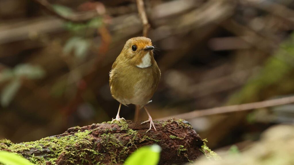
The Ucayali moist forests are a crucible of life, harboring a remarkable concentration of species. These forests are home to at least 188 recorded mammal species and over 600 bird species. The broader Peruvian Amazon, of which Ucayali is a vital part, contains approximately 10% of the world’s flora species, over 2,000 species of fish, more than 1,700 bird species (ranking second globally in avian biodiversity), and over 450 amphibian species.
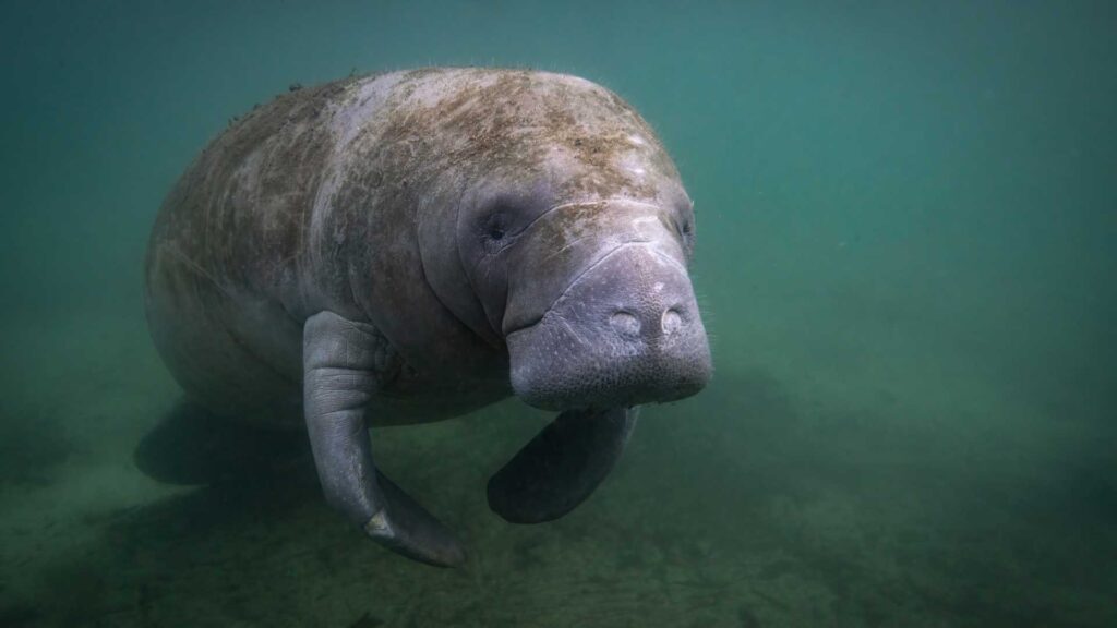
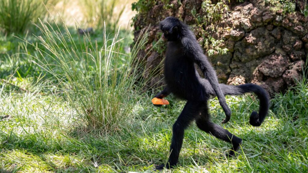
- Mammals: The iconic tapir is listed as vulnerable. Other threatened mammals include the Giant Otter (Endangered – EN), Black-faced Black Spider Monkey (EN), Peruvian Woolly Monkey (EN), Amazonian Manatee (VU), and the endangered Peruvian spider monkey, whose populations are restricted by habitat loss.
- Birds: The rare black-tailed antbird faces a high level of danger. Other avian species at risk include the Sira Curassow (Critically Endangered – CR), Blue-headed Macaw (VU), and the Lemon-browed Flycatcher (VU). Unique species like golden-collared toucanets are also found in the region.


The sheer number of species classified as “Vulnerable (VU),” “Endangered (EN),” and “Critically Endangered (CR)” underscores a grim reality: Ucayali is not just losing trees, but is on the verge of localized extinctions, and in some cases, contributing to the global extinction risk of unique species. This represents an irreversible loss of genetic heritage.
Disruption of Critical Ecosystem Services
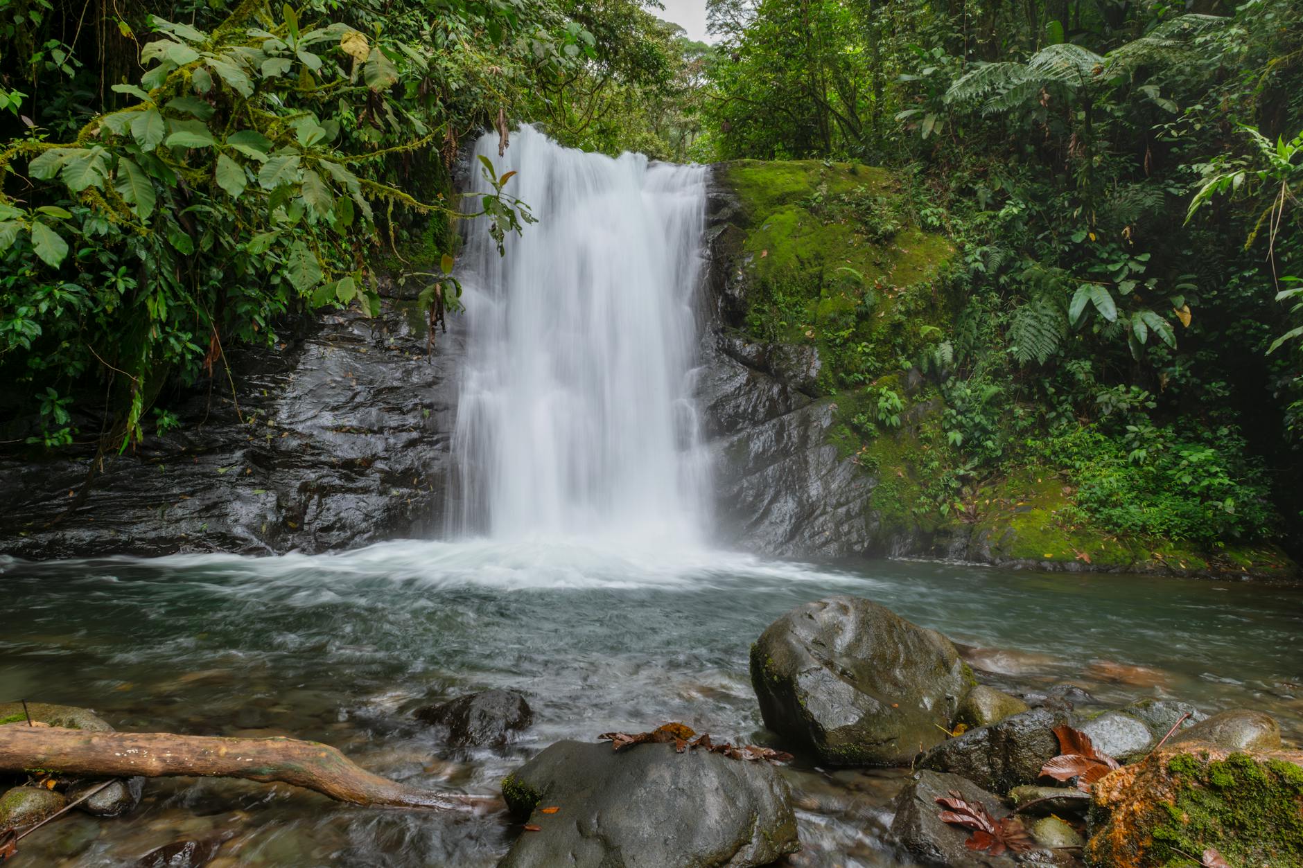
Ucayali’s forests provide vital ecosystem services beyond biodiversity, acting as critical carbon sinks, especially the peat-rich “aguajales” (palm swamps). Their destruction releases massive amounts of stored CO2, worsening climate change. These forests also regulate rainfall through evapotranspiration, maintaining river flow crucial for wetlands, fisheries, and agriculture.
Loss of forest cover severely impacts soil stability and nutrient cycling. Deforestation exposes soil to heavy rains, leading to increased erosion, land degradation, and fertility loss. While the Ucayali River naturally carries Andean sediment, watershed deforestation can worsen erosion and river sedimentation, negatively affecting water quality, aquatic habitats, and vital infrastructure. The decline of these services depletes Ucayali’s natural resources and has far-reaching global consequences, particularly for climate regulation.
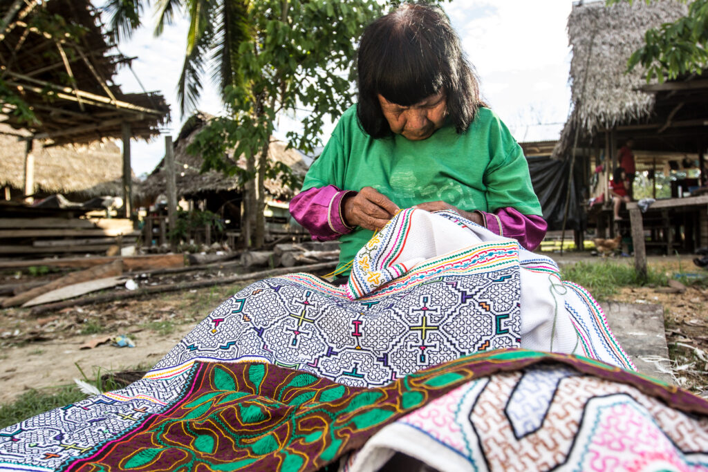
The Human Toll: Indigenous Peoples and Local Communities
For the eighteen distinct indigenous nations of Ucayali, including the Shipibo-Conibo and Asháninka, the forest is foundational to their existence. It serves as their home and heritage, the wellspring of their language, art, and spiritual practices. It is also their medicine cabinet, providing hundreds of plant species for treating various ailments, and their grocery store, with rivers abundant in fish, game for protein, and wild fruits for nutrition.

However, as loggers, miners, and coca farmers encroach on their ancestral lands, sacred sites vanish, severing cultural ceremonies tied to specific groves and ceiba trees. Traditional diets erode, replaced by packaged foods that contribute to malnutrition, especially in children. Consequently, families are forced to uproot and migrate to distant towns, fracturing intergenerational knowledge transfer and community bonds.
Health concerns multiply when mercury from illegal gold mining seeps into waterways, contaminating fish and drinking sources. Altered microclimates bring more mosquitoes, triggering spikes in malaria and dengue. Psychosocial stress—driven by land loss and cultural dislocation—fuels anxiety and depression. Some communities adapt by growing coffee or bananas, creating needed income but also tying them into market forces that demand even more land. This shift illustrates a painful paradox: in seeking survival, these groups can inadvertently drive the very deforestation that threatens their future.
Conclusion: A Lifeline for Ucayali—Fund The Planet’s Vision for Hope and Regeneration
In the face of Ucayali’s accelerating deforestation crisis, a crisis that threatens not only ancient forests and irreplaceable biodiversity, but also the lifeways of indigenous peoples and the global climate balance. Fund The Planet offers a tangible, impactful path forward. By purchasing endangered rainforest land and transforming it into legally protected nature reserves, Fund the Planet is actively defending one of Earth’s most vital ecosystems from further degradation.
This model doesn’t just halt chainsaws, it empowers everyday individuals to become guardians of the Amazon. Through transparent ownership and digital stewardship, anyone can claim responsibility for a piece of the Ucayali rainforest, helping to protect it from destruction while supporting a broader vision of sustainability and environmental justice. Whether you’re in Berlin, Melbourne, or anywhere else in the world, your action can ripple through the heart of the Peruvian Amazon.