You’re looking at a map of the Peruvian Amazon. Rivers wind through a stretch of green, and a boundary marks out Cordillera Azul National Park. Inside that line, the forest has the protection of a national park. Outside it, the canopy continues. From above, there is no obvious reason why one stretch of rainforest should have a more secure future than the next.
Yet the difference is stark. A study of Cordillera Azul reported more than 262,000 hectares of forest lost in its surrounding buffer zone between 2001 and 2021, compared with about 7,660 hectares inside the park. The trees outside the boundary were still part of the Amazon. Their future was shaped by different land-use pressures and a different set of rules.
Rainforest buffer zones bring that tension into focus. Governments recognise that the land around a protected area matters. But recognising its importance and keeping its forests standing are two different tasks. This is where conservation beyond the park boundary becomes essential.
What a rainforest buffer zone actually means
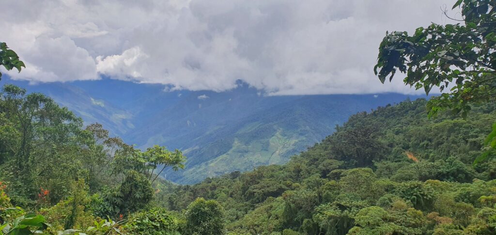
Cordillera Azul National Park was established on 21 May 2001. It protects more than 1.35 million hectares, stretching from mountain forests towards the Amazonian plain. Its headwaters supply the surrounding region, and its forests shelter wildlife including tapirs, river otters and large birds of prey. The park protects a living system whose connections extend beyond its borders.
Around it lies the zona de amortiguamiento, or buffer zone. Think of this as the area where what happens outside the park can affect what survives inside it. Clearing nearby forest, opening access routes or damaging waterways puts pressure on the wider ecosystem. The buffer zone exists to help manage those pressures.
Article 25 of Peru’s Protected Areas Law requires activities in buffer zones to respect the conservation purposes of the neighbouring protected area. National parks operate under a stricter regime that prohibits natural-resource extraction. Buffer zones accommodate a mix of communities, private properties and compatible economic activities. They are a place to reconcile conservation with life around the park, rather than an extension of the park’s strict protection.
That difference matters on the ground. A forest parcel can sit within an officially designated buffer zone and still face pressure from agricultural expansion or logging. Its proximity to a national park makes conservation important, but does not make protection automatic.
Cordillera Azul: the contrast in numbers
A 2025 study using Peru’s Geobosques forest-monitoring data examined Cordillera Azul and its buffer zone separately. For 2001 to 2021, its tables report 262,014.70 hectares of forest loss in the buffer zone, compared with 7,659.64 hectares inside the national park. The surrounding loss amounts to more than 2,620 square kilometres of forest.
The contrast remains striking when the different sizes of the two areas are taken into account. Reported forest loss occupied 11.37% of the buffer zone’s total land area, against 0.57% of the park’s. That is roughly a 22 times difference in the share of land affected. By 2022, forest covered 98.05% of the park’s total area, compared with 73.43% of the buffer zone.
These figures put the vulnerability of the surrounding forest into perspective. The park’s canopy remained largely intact while substantial areas beyond its boundary were lost. The surrounding zone also contained agricultural land and settlements, with demands on the forest that differ from those inside the park.
There is still a great deal worth protecting. The study mapped around 1.69 million hectares of forest remaining in the buffer zone in 2022. Conservation there means securing living forest before further clearing takes place, alongside restoring areas already damaged.
Tambopata and Bahuaja Sonene show the wider pressure
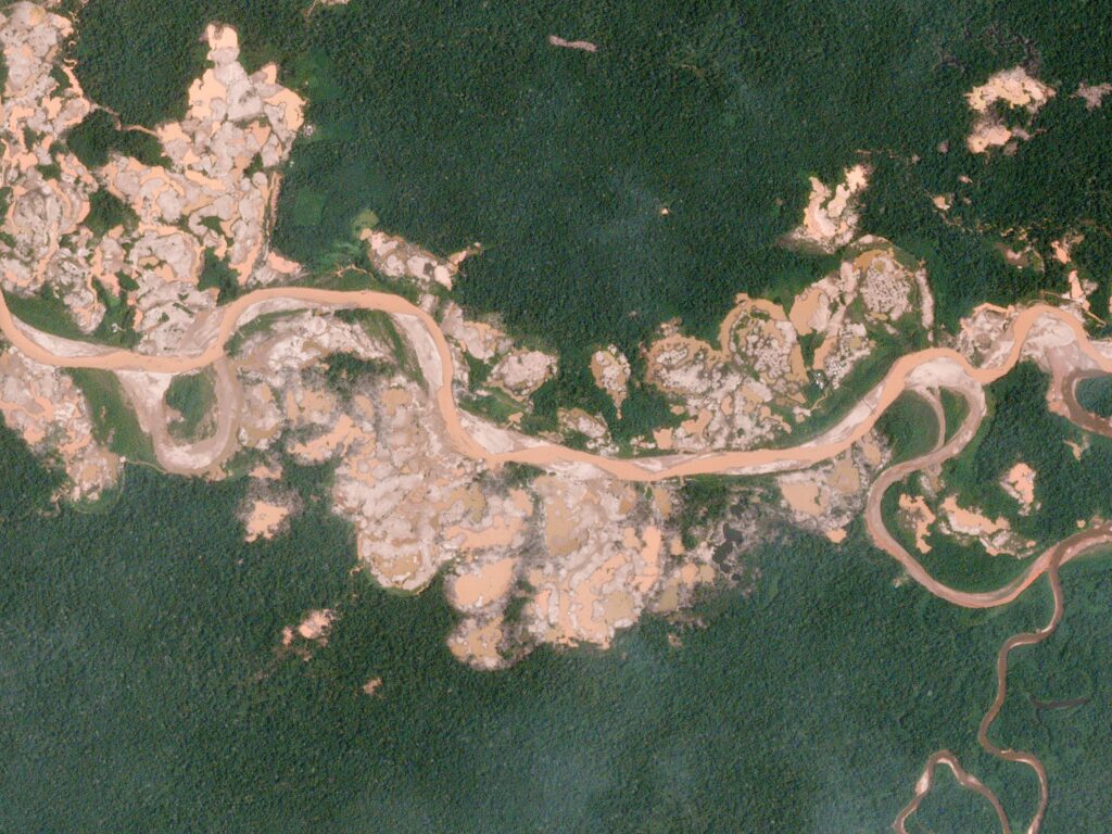
Cordillera Azul is one example of a problem visible elsewhere in the Peruvian Amazon. In the buffer zone of Tambopata National Reserve, gold mining has stripped away forest in places where proximity to a protected area offered little defence against the demand for gold.
The Monitoring of the Andes Amazon Program, or MAAP, documented 2,774 hectares cleared between 2013 and 2015 in just two mining hotspots, La Pampa and Upper Malinowski. Both were within Tambopata’s buffer zone. A designation meant to safeguard the reserve’s surroundings coexisted with thousands of hectares of clearing for gold.
Further south, MAAP examined the Colorado sector of Bahuaja Sonene National Park and the surrounding buffer zone. It found 1,172 hectares of buffer-zone deforestation between 2001 and 2014, alongside 538 hectares lost inside the park in the same sector. Agricultural expansion and cultivation associated with coca were among the pressures identified. Here, the forest was being converted for a different purpose, but the vulnerability around the boundary was familiar.
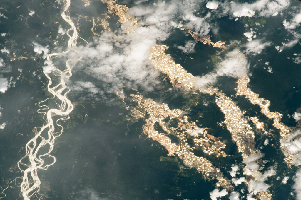
A later MAAP assessment recorded 876 hectares of gold-mining deforestation in protected-area buffer zones outside southern Peru’s Mining Corridor during 2021 and 2022. The most affected buffer zones included Tambopata, Bahuaja Sonene and Amarakaeri. The same report documented the government’s success in essentially halting mining expansion in La Pampa after Operation Mercury began in 2019. Enforcement made a difference there, while pressure remained elsewhere around protected areas.
Together, these examples show why conservation cannot stop at the park gate. Buffer zones are places where the demand for farmland, timber or gold meets forests that still have immense ecological value.
Why the government cannot simply make every park bigger
Looking at those losses, expanding the national park seems like an obvious answer. But extending strict protection over a buffer zone changes what people can do with the land. It involves existing property rights, livelihoods and decisions about which uses must end or change. A new boundary has consequences for the people already living on either side of it.
Peru’s protected-areas law addresses those realities. It provides for restrictions and, where applicable, compensation when private property is included in a protected area. It also recognises compatible traditional uses and the participation of Indigenous and rural communities. Turning an inhabited area into a national park therefore requires more than a conservation ambition. It requires a workable arrangement for the people and rights involved.
Powerful commercial interests can also resist protection. In the Cordillera del Cóndor, an ODECOFROC investigation published by IWGIA in 2010 describes intensive lobbying by mining company Afrodita against the original proposal for Ichigkat Muja National Park. According to the investigation, the company persuaded government departments to recommend a smaller protected area. The report reproduces minutes of a November 2005 government-company meeting pressing for a favourable opinion on mining exploration. The dispute shows how conservation proposals can collide with extractive interests before a park boundary is even agreed.
Community participation is a different issue from commercial lobbying. People need a say in decisions affecting their homes and resources, and conservation needs their involvement to last. Buffer zones give governments a way to protect the surroundings of a park while accommodating compatible livelihoods. Making that approach work requires sustained attention to land use, local needs and the pressures that drive clearing.
Protecting more forest requires funding that lasts
A park designation is a beginning. Rangers need salaries, remote sites need transport, and monitoring and enforcement need resources year after year. Expanding protection means sustaining those responsibilities over a larger area. The cost continues long after the boundary is drawn.
The funding challenge is documented. A Green Climate Fund proposal approved in April 2026, covering 25 protected areas in Peru’s Amazon biome, identifies an annual financing gap of US$5.3 million for those areas. Its approach combines better protected-area management with work in selected buffer zones and new sources of recurring finance. Even existing protected areas need additional funding to reach the management standards the programme targets.
The difficulty is not that standing forest has no economic value. Clean water, tourism and climate regulation all bring benefits, and the proposal includes tourism entrance fees and payments for water-related ecosystem services among its financing mechanisms. But a benefit to society does not automatically become money available for a ranger’s salary. The proposal makes that mismatch explicit: much of the climate benefit reaches the wider world, while mitigation costs have traditionally fallen on the Peruvian state.
Conservation needs ways to connect those benefits with dependable funding. Public budgets, community-led management and private conservation each have a role. Adding capacity around a park helps address the gap between wanting forests protected and having the resources to protect them.
Where private conservation steps in
Peru’s conservation framework already makes room for this approach. Article 62 of the protected-areas regulation promotes private conservation areas, habitat restoration and agroforestry in buffer zones, with priority given to local participation. Private conservation can add committed land stewardship and funding around the public protected-area system.
At Fund The Planet, our model is to acquire rainforest land particularly from owners who may be in a position to sell it for other negative use cases, for the sole purpose of conservation and fund its protection through memberships. Our project is in the Sarayacu area of Loreto. The October 2021 environmental assessment located the land it examined within Cordillera Azul’s buffer zone, outside the national park. It described forest in good conservation condition alongside disturbed areas and risks from farming and logging. This is forest where a commitment to conservation has a practical purpose.
That commitment involves work on the ground. In August 2024, our team completed boundary-marking work at the Sarayacu project, using GPS equipment to follow the perimeter and place signs. Transporting materials into the forest, working through heavy rain and dealing with drought were part of the job. These are the less visible demands behind protecting a place that looks effortlessly green in a photograph.
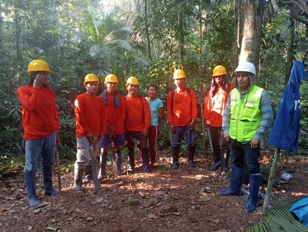
Our transparency page brings together purchase documents, the environmental study and project reporting. It connects the conservation model with a specific place and records of the work behind it. For members, recurring contributions support a model designed around keeping forest standing rather than converting it to another use.
The trees around Cordillera Azul do not become less valuable when they fall outside the national park. The loss of more than 262,000 hectares in its buffer zone shows the scale of the challenge, while the forest still standing shows what remains possible to protect. That work needs public safeguards, local involvement and funding that can continue beyond a single project or announcement.
The next time you see a national park outlined on a map, look at the green beyond its boundary too. Protecting that forest helps keep the wider ecosystem connected and gives conservation more room to succeed. It is the reason Fund The Planet’s work belongs alongside the park: the rainforest beyond the line still needs a future as forest.

 EN
EN  DE
DE